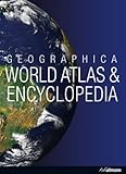
Geographica world atlas & encyclopedia.
Material type: TextPublication details: [Germany] : h.f. Fullman, c2007.Description: xxi, 610 p. : col. ill. 24 cmISBN:
 - 9783833141256
- G 63 .G292 2007
| Item type | Current library | Call number | Status | Date due | Barcode | |
|---|---|---|---|---|---|---|
 Reference
|
Aklatang Emilio Aguinaldo-Information Resource Center Reference | G 63 .G292 2007 (Browse shelf(Opens below)) | Not for loan | 3AEA0000306949 |
Originally pub.: Australia : Random House, c1999.
Contains maps and detailed text on the world's 193 nations whichare members of the United Nations and 65 dependencies and overseas territories. It presents the world as divided into major continents or regions: Oceania, Asia and the Middle East, Europe and the Russian Federation, Africa, North America and central America, South America, Polar Regions, And Oceans.Each regions tarts with an introductory essay on the region in general and then moves on to entries for every country, territory or dependency. The country entries feature informative descriptions of the nation and its people, physical features and land use, culture, and economy and resources. Each country entry includes a locator map, the national flag, a locator globe and a Fact File. Entries for the major nations also include a historical timeline. The entries for the dependencies and territories follow the country entries. The Fact File contain a wealth of carefully researched information for quick access to each nation's key indicators, such as form of government, infant mortality, literacy, ethnic diversity , regions economy, as well as basic data including official name, population, language, currency, and climate. Regional maps are at the end of each section . Physical and political maps for each region are followed by more detailed mapping. Recent name changes and boundary changes are shown on the maps.
There are no comments on this title.


